




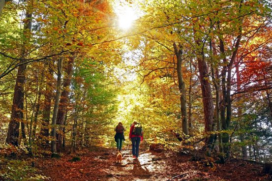
A forest trail beneath golden leaves. A lookout over Beaver Valley. Georgian Bay stretching beyond a colourful escarpment. If you’re looking for the best fall hikes near Collingwood, you don’t have to choose just one kind of scenery.
Collingwood and the surrounding Southern Georgian Bay communities offer everything from gentle rail-trail walks to rugged Niagara Escarpment hikes. The trick is choosing an outing that matches your experience, your available time and the kind of view you’re hoping to find.
At Keleher + Co., we believe getting to know a community means looking beyond its homes. It means discovering where to spend a Saturday morning, which local stops can turn a hike into a memorable day, and what might bring you back season after season. Whether you’re planning an autumn getaway, visiting friends or imagining your own second home in Southern Georgian Bay, these eight outings offer a wonderful introduction to the area.
The best Collingwood-area fall hikes at a glance
For Georgian Bay views, start with Loree Forest or Scenic Caves. For a Beaver Valley panorama, put Old Baldy on your list. For forest colour and rugged escarpment terrain, consider Petun, Pretty River Valley or Kolapore. For a gentler walk, choose a short section of the Georgian Trail.
Fall 2026 access alert: A Bruce Trail section within Devil’s Glen Country Club is scheduled to be closed September 19–October 18, 2026. The Bruce Trail Conservancy notice says the provincial park parking lot and viewing platform remain open. Check the live notice before visiting; do not assume a longer loop is available.
1. Loree Forest: woodland colour and Georgian Bay views
Location: The Blue Mountains, south of Thornbury
Difficulty: Easy–moderate
Best for: A forest loop with a scenic payoff
Loree Forest, also known as the Len Gertler Memorial Loree Forest, combines woodland walking, open sections and a viewing opportunity toward Georgian Bay. In autumn, that mix makes it especially appealing: you can enjoy the leaves close up beneath the canopy, then appreciate the wider landscape near the Georgian Peaks ski-hill setting.
The commonly described loop is approximately five kilometres, although the connector and route you follow can change the total. Much of the walking is relatively level, but exposed roots, rocks and slippery leaves mean it should not be mistaken for a smooth paved path.
Planning tip: Access information changed in 2026. The Bruce Trail Conservancy’s Map 24 update identifies off-road parking on 21st Sideroad and access via the 5th Line Side Trail. Follow current maps and signs rather than relying on older directions. Check parking restrictions and payment requirements at your chosen access point.
2. Devil’s Glen: dramatic escarpment and gorge scenery
Location: Glen Huron, south of Collingwood
Difficulty: Moderate–strenuous on longer routes
Best for: Escarpment scenery and a designated viewing platform
Devil’s Glen Provincial Park offers a different side of fall hiking near Collingwood. Rock outcrops, steep forested slopes and the Mad River gorge create a dramatic landscape where autumn foliage can contrast beautifully with the escarpment.
Longer Bruce Trail outings in this area can involve hills and demanding footing. That makes them a better fit for hikers prepared for a more substantial outing than for someone expecting an easy woodland stroll. The park also has a viewing platform, giving visitors a distinct scenic destination without treating the entire surrounding trail network as one hike.
Important for fall 2026: The Bruce Trail Conservancy’s closure notice affects a section within Devil’s Glen Country Club through October 18. The notice leaves the provincial park lot and viewing platform open, but it does not mean the longer routes are uninterrupted. Follow posted closures and check current access before leaving home.
Keleher + Co. after-hike pick: Nottawa General. Make a stop at Nottawa General Store in the village of Nottawa for specialty coffee, house-made food or a browse through the general store. With gourmet provisions and artisan gifts alongside the café, it’s an inviting addition to a fall day out—and a handy place to discover a few things for your weekend retreat. Check current café hours and food availability before planning your stop.
3. Petun Conservation Area: a rugged forest-colour outing
Location: 2nd Line, The Blue Mountains
Difficulty: Moderate on the published route described below
Best for: Woodland colour, rock formations and escarpment terrain
Petun Conservation Area sits at one of the Niagara Escarpment’s higher elevations. Its rocky formations, cliffs, crevices, mosses and ferns give it plenty of character beyond the changing leaves.
Think of Petun as a forest-and-geology experience, rather than choosing it solely for a guaranteed wide-open panorama. It suits hikers who enjoy natural terrain and want an autumn outing with more texture than a rail-trail walk.
A Bruce Trail club route listing describes an approximately 8.4-kilometre outing using the Black Ash Side Trail, main Bruce Trail and John Haigh Side Trail, with a 4.2-kilometre shorter option. Treat those as published route options—not proof that every connection is open—and consult a current map before choosing your hike.
Planning tip: The conservation authority lists daily vehicle parking at $15 plus HST and dawn-to-dusk access. Confirm current parking information and trail notices before visiting. Some nearby side-trail sections have annual winter closures, so don’t assume an autumn route remains available in every season.
4. Old Baldy: one of the area’s standout fall lookouts
Location: Near Kimberley, in Beaver Valley
Difficulty: Easy–moderate approach, with a rugged, steep section near the cliffs
Best for: A short lookout outing with a big valley view
If your idea of fall hiking involves looking across a broad patchwork of treetops, Old Baldy Conservation Area belongs on your list.
The escarpment lookout stands approximately 152 metres above Beaver Valley and the village of Kimberley. When the leaves turn, the wooded valley becomes the centrepiece of the view. This is a Beaver Valley outing, not a trail within Collingwood itself, and that wider geography is part of the appeal of having a home base in Southern Georgian Bay.
The operator describes the approach from the parking area as approximately 15 minutes to the lookout. That is an approximate one-way walk, not the total visit time, and the approach becomes more rugged near the cliffs. Allow time for careful footing, enjoying the view and returning to your vehicle.
Planning tip: Grey Sauble Conservation’s parking information lists daily parking at $10 plus HST, payable by debit or credit. Spaces are first-come, first-served. If the lot is full, choose another outing rather than blocking access or parking illegally. Stay well back from cliff edges.
Keleher + Co. after-hike pick: Heart’s Tavern. Pair the Old Baldy lookout with a meal at Heart’s Tavern and Bar in Kimberley. Its classic European fare and seasonal features make a lovely complement to an afternoon exploring Beaver Valley. Plan around the restaurant’s current serving hours and check table availability before you go—especially for a weekend visit.
5. Pretty River Valley: an immersive autumn forest hike
Location: Pretty River Road, near Collingwood
Difficulty: Moderate–strenuous, depending on route and conditions
Best for: Hikers who enjoy forest, valley scenery and varied terrain
Pretty River Valley Provincial Park is a good choice when you want the walk itself—not just a single lookout—to be the attraction. The Bruce Trail passes through a landscape shaped by glacial activity, with slopes, channels and rugged features that make the terrain as interesting as the seasonal canopy.
For fall colour, think woodland immersion: changing leaves along the trail, the valley setting and the feeling of spending time in escarpment country. It is a more demanding option than a gentle town trail, particularly when wet leaves cover uneven footing.
One documented approach is the Pretty River Access Side Trail, a 510-metre one-way connection from parking on Pretty River Road to the main Bruce Trail. The complete outing is longer once you continue on the main trail. Choose a turnaround based on your group’s ability, daylight and a current map rather than assuming there is one standard park loop.
Planning tip: Do not count on park facilities. Check Ontario Parks’ current alerts and parking or permit requirements, and use only permitted parking areas.
6. Kolapore Uplands: wilderness-style walking near Ravenna
Location: Near Ravenna, southwest of Collingwood
Difficulty: Moderate on the described route; the wider network varies
Best for: A longer natural-surface forest outing
The Kolapore Uplands trail network offers a wilderness-style experience through wooded escarpment terrain. It is an appealing addition for hikers who want more time beneath the autumn canopy and enjoy a route with natural footing and rock scenery.
The network is approximately 50 kilometres, but that is not the length of a single hike. One documented Bruce Trail club outing is an eight-kilometre loop from the County Road 2 parking area via Kolapore Church Trail, Metcalfe Rock Trail and Paradise Highway Trail. Its moderate classification includes hills and the possibility of poor footing.
This is a forest-first choice rather than a promise of uninterrupted panoramic views. Carry a current map and select a route that suits your experience.
Planning tip: The trail association asks users to stay off trails after heavy rain. Check current conditions, landowner notices and hunting-season guidance before visiting. Once snow arrives, the network’s ski-trail rules differ from autumn hiking rules.
7. Scenic Caves: fall views from the suspension bridge
Location: Scenic Caves Road, The Blue Mountains
Difficulty: Moderate by terrain; stairs, heights and uneven ground require care
Best for: A planned, paid outing with elevated viewpoints
Scenic Caves Nature Adventures is a paid attraction, not a free public trail. Its forest paths, escarpment viewpoints and 420-foot suspension bridge offer a memorable way to see Georgian Bay and the seasonal canopy from above.
The operator estimates approximately 10–25 minutes from the main gate to the bridge, depending on the route. That is only the approach. If you plan to explore the caves, caverns and other features too, allow a longer visit; the operator recommends at least two hours for the caves and bridge experience.
Do not mistake a managed attraction for effortless walking. Routes can include uneven ground, rocky sections and steep stairs, and the bridge experience may not suit everyone who is uncomfortable with heights.
Planning tip: Check current fall hours and admission before going. Proper running or hiking shoes are mandatory, and the operator has a no-pets policy, with service-animal guidance addressed separately. Weather can affect trail and bridge availability.
8. Georgian Trail: a gentler way to enjoy fall in Collingwood
Location: Collingwood, Thornbury and Meaford
Difficulty: Easy grade; choose a manageable distance
Best for: A flexible walk without an escarpment climb
Not every autumn outing needs to involve a cliff or a steep ascent. The Georgian Trail offers a flatter, firm-surface alternative through wooded stretches, waterfront communities and countryside along Southern Georgian Bay.
The full trail is approximately 33–34 kilometres one way, so think in sections. Start near Harbourview Park in Collingwood or choose an access point closer to Thornbury or Meaford, then walk to a comfortable turnaround and return the same way. It is a linear trail, not a loop.
You will trade escarpment panoramas for a gentler pace and a different kind of scenery. For visitors fitting outdoor time into a weekend getaway, that flexibility is part of the appeal: a short trail walk can be just as enjoyable as a major hike.
Planning tip: The Georgian Trail is shared by different users. Keep right, pay attention at road crossings and leave room for others. Check municipal notices and parking signs at your selected access point.
When is the best time to see fall colours near Collingwood?
Monitor conditions through September and October rather than booking around one guaranteed peak weekend. Colour changes at different times across Southern Georgian Bay, and elevation, tree species, temperature, wind and rainfall can affect what you see.
Before your outing, check a recently dated regional fall-colour report and, where relevant, the Ontario Parks fall-colour report. Check the report date as carefully as the colour percentage. A regional report is useful guidance, but it is not a live assessment of every trail or viewpoint.
If your schedule is flexible, a weekday outing may offer a more relaxed experience at popular destinations. Build in time to enjoy the scenery safely, and plan to finish before dark.
Before you head out: practical fall-hiking tips
• Check access first. Read current park, conservation-authority and Bruce Trail notices, especially for Devil’s Glen and routes crossing private land.
• Wear suitable footwear. Wet leaves can hide rocks, roots and mud. A trail described as easy is not necessarily smooth or accessible.
• Bring a current map. Download it before departure; do not rely on continuous cell coverage.
• Allow for shorter daylight. Carry water, snacks, layers and a charged phone, and let someone know your plan.
• Park responsibly. Confirm payment or permit requirements, and never block farm gates, driveways or emergency access.
• Respect the landscape. Stay on marked trails, give wildlife space and remain well back from cliffs and crevices.
• Check the rules for your group. Pet policies, mobility needs and attraction requirements vary by location.
From a fall weekend to your own four-season retreat
A great autumn hike can leave you thinking about more than the view. Perhaps it’s the idea of returning to a favourite trail, bringing friends for a weekend, or making a stop at a local café part of your own getaway routine.
For visitors, the best way to get to know Southern Georgian Bay is to explore more than one part of it. A walk in The Blue Mountains feels different from a lookout in Beaver Valley or a café stop in Nottawa. Those small discoveries are often what turn a first visit into a place you want to return to.
For second-home buyers, that is the appeal of a home base here: a place to settle into between adventures, welcome guests and enjoy the region beyond a single season. The right property should fit the way you actually spend your time away—whether that means a lower-maintenance condo, room for visiting family or a quieter setting with space to unwind.
Local knowledge helps connect that picture to the practical details. How much upkeep do you want? What will winter access involve? How convenient is the location for the activities and communities you enjoy? If you’re considering a condo, do its rules and services suit your intended use? A scenic address alone does not answer those questions—or guarantee public trail access from the property.
At Keleher + Co., we help you get to know the communities as well as the homes, so your second-home search starts with the lifestyle you want and the considerations that matter to you. Explore our Southern Georgian Bay community guides or browse current featured listings when you’re ready to take a closer look.
Imagining your own four-season retreat? Use the contact form alongside this article to connect with Keleher + Co. about a second home in Collingwood or the surrounding Southern Georgian Bay communities.
Frequently asked questions about fall hiking near Collingwood
Which hikes near Collingwood have the best fall-colour views?
For a wide valley panorama, consider Old Baldy near Kimberley. Loree Forest offers a Georgian Bay viewing opportunity, while Scenic Caves combines elevated forest and bay views with its suspension bridge. Petun, Pretty River Valley and Kolapore are better approached as forest-and-escarpment outings. Conditions and visibility vary.
What is the easiest fall walk in this guide?
A short section of the Georgian Trail is the gentlest option by grade. Choose your turnaround carefully: a flat trail can still become a demanding outing if you walk too far. Loree is relatively level in places but has natural footing, including roots and rocks.
Is Devil’s Glen open for fall hiking in 2026?
A Bruce Trail section within Devil’s Glen Country Club is scheduled to close September 19–October 18, 2026. The notice says the provincial park parking lot and viewing platform remain open. Check the current Bruce Trail notice and Ontario Parks information before visiting, and do not assume longer routes are fully available.
Is Scenic Caves a free hike?
No. Scenic Caves Nature Adventures is a paid attraction. Check its current admission, operating hours, footwear rules and activity availability before your visit.
Can I bring my dog on these fall hikes?
Check each operator’s current rules rather than assuming one policy applies everywhere. Scenic Caves has a no-pets policy, with service-animal information addressed separately. Other parks and trails may require leashes or have seasonal restrictions.
Where can I stop for food after an Old Baldy or Devil’s Glen outing?
Keleher + Co.’s suggested pairings are Heart’s Tavern and Bar in Kimberley after Old Baldy, and Nottawa General Store in Nottawa after Devil’s Glen. Check current opening and serving hours before you set out; for Heart’s, check table availability too.
Planning information researched and revised October 5, 2026. Fees, access, rules, restaurant hours and conditions can change. Recheck the linked operators before travelling. The descriptions do not confirm current leaf colour or guarantee peak foliage.